Overview
Ever since Edmund Hillary and Tenzing Norgay first summited Everest in 1953, the dream of reaching its base camp has captivated countless souls. But that is possible only if you have a reliable trek map. Maps are your silent guide through the Khumbu region, turning vague trails into clear paths amid Nepal’s towering Himalayas.
While options range from detailed topographic charts with contour lines to simple schematic sketches and interactive digital apps, an infographic-style visual map stands out for its accessibility.
The Everest Base Camp trek map by Radiant Treks is one such route map. It blends visual storytelling with practical details so that you can navigate from Kathmandu to the foot of the world’s highest peak with ease.
Think about it: starting in Kathmandu, your journey often begins with a schematic flight line to Lukla, marked on such maps to highlight that entry point.

From there, illustrated routes snake through villages like Phakding and Namche Bazaar, using symbols for bridges over rivers and icons for teahouses.
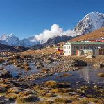
It covers the roughly 130-kilometer round trip, showing ascents to Tengboche’s monastery, Dingboche, and onward to Lobuche and Gorakshep. This ends at EBC, depicted with tent symbols.
What makes a map like this indispensable is how it layers in realities: altitude graphs warning of thin air risks, indexes decoding health posts and passes to fend off storms, and side paths hinting at detours.
In a trek where weather can bury trails in snow or altitude can ground you, the map keeps you on track on the EBC route. That is why trekkers need it for navigation, building anticipation and safe returns. In short, the EBC trek map transforms a daunting expedition into an achievable adventure.
Highlights
- Explore a variety of EBC trek map options, including detailed topographic charts and route maps
- Visual route maps are perfect for tailoring the EBC trek according to your fitness and experience level
- The teal circles with orange route lines and integrated icons in Radiant Treks’ map are for easy navigation
- Learn to decode helpful icons that mark lakes, health posts and mountain passes
- Uncover hidden gems along the trek trail via symbols and icons mentioned in the trek map
- Get a clear breakdown of the trek’s ascent, high-altitude zones and descent routes, highlighting key waypoints, rest points and optional side trails
- Refer to the simple altitude line graph for understanding daily elevation changes
Types of EBC Trek Maps

When you are gearing up for the Everest Base Camp trek, a good map isn’t just helpful — it’s your lifeline in those remote Himalayan stretches. Over the years, a variety of maps have been released. And they cater to everyone from seasoned mountaineers to first-time hikers.
Let’s break it down, keeping in mind how these options stack up against something like the Radiant Treks’ route map, which blends simplicity with key details.
Topographic Maps
First off, topographic maps are the real powerhouse when it comes to accuracy. Think of ones from National Geographic or the Nepal Survey Department. They show contour lines that map out every hill and valley, elevations down to the meter, and features like rivers, glaciers, and forests.
They are scaled accurately, say 1:50,000, so you can measure distances spot-on. If you are into off-trail exploring or need to gauge steepness for training, these are gold.
But such maps can feel overwhelming if you are not map-savvy. They are full of technical symbols, and this requires a good knowledge of reading a map.
Infographic Maps
Infographic maps take it up a notch by turning data into visuals. The Radiant Treks version is a prime example, combining a route map with an itinerary list, symbol index and altitude graph, all on one page.
This map is not about perfect scale. But it presents an overview of the EBC trek route. For instance, in this trek map of Everest Base Camp, orange lines trace the trek trail. Green dots indicate resting stops and icons symbolize lakes or health posts. These are best for visual learners who are planning the trek from home. They offer a quick insight into the trek route without needing a compass.
Digital and GPS Maps
Digital and GPS maps bring technology into the mix. Apps like Maps.me or Gaia GPS are downloadable so that you can use them offline. They overlay satellite imagery and even track your pace in real time. You can zoom into areas like the Khumbu Glacier or add waypoints for emergencies. Such maps are interactive, updating with user reports on trail conditions.
The only drawback is that they rely on battery life. As such, they might not be reliable in cold, higher elevations where power banks freeze.
A Comparison
Comparing these, the Radiant Treks map shines as an infographic for beginners. That is because it is accessible, colorful and packs extras like contact info for quick queries.
Topographic maps are best suitable for professionals and digital maps are for gadget fans. Nonetheless, mixing types — like using Radiant’s overview with a topo for details — gives the best edge.
Understanding Map Layout

The infographic map by Radiant Treks is like a treasure chart that is tailored for those planning the Everest Base Camp trek. This isn’t your standard fold-out paper. It is a digital-friendly design that’s all about making the trek look approachable. And it is useful for planning an Everest Base Camp trek as well as for finalizing the route.
Vertical Layout
The map is designed in a way to showcase the ascent of the trek. It starts at the bottom with Kathmandu at 1,400 meters and then rises to the top, where peaks like Everest at 8,848 meters dominate.
The wavy orange line is the trek route. It snakes through villages and passes in a way that’s illustrative and keeps things uncluttered. For instance, Lukla’s airport icon jumps out with a plane symbol, emphasizing the flight start. Meanwhile, the path widens at busy hubs like Namche Bazaar.
Visual Elements
The Everest Base Camp trek map presents visual elements that are easy to understand. On the left, there’s an index listing symbols — lakes as blue ovals, mountains as blue peaks, health posts as ‘H’ icons — all explained simply.
The right side features an itinerary of the 12 Days Everest Base Camp Trek. You can see the numbered list here, from Phakding on day 1 to Kathmandu on day 12. And this list syncs with route points as presented in the map.
At the bottom of the map, you can see an altitude chart that graphs the journey’s ups and downs. Blue dots point out the daily elevation you attain and the graph reaches as high as 5,545 meters.
Contact and Readability
The map also presents the contact details, but in a subtle manner. So, if you want to contact Radiant Treks, you may refer to this route map.
Radiant Treks logo sits top-left and contacts like WhatsApp +977 9851076831 and email (info@radianttreks.com) at the footer. You can contact us at the details or visit the agency’s website if you want details about the trek or the map.
You should refer to this Everest Base Camp trek map because of its readability. Fonts are clean and colors contrast well. Orange on teal ensures nothing blends in. And there is enough white space to avoid overwhelming the viewers. Thus, this map is optimized for screens as well as for prints.
Finishing Touches
Additional touches add flavor to the EBC trek map. The illustrative mountains like Pumo Ri at 7,165 meters or Everest at 8,848 meters frame the top of the map. And this, in a way, gives a sense of scale.
In addition, side paths dash off to places like Gokyo Lakes, hinting at extensions without distracting from the main route.
Therefore, this design isn’t just pretty, it is functional as well. You can visualize the trek’s flow from forested lows to barren highs if you take this map as a reference.
In a region where weather and altitude rule, such clarity can make all the difference. That is in the sense that you can make necessary preparations for the trek, and turn potential confusion into confident steps.
Symbols and Index

Symbols on the Everest Base Camp trek map are like secret codes for trekkers on this route. If you are able to crack them, then suddenly the path reveals its stories. The Radiant Treks’ map’s index, placed on the left, is a straightforward key that unlocks everything from safety spots to scenic detours.
The following section explores them, based on what’s right there in the design.
Natural Landmarks
Start with the basics: lakes shown as blue ovals, like the cluster for Gokyo Lakes, remind you of those turquoise gems amid the rocks.
Mountains are blue peak icons, labeling giants such as Ama Dablam or Nirekha Peak. Each icon for a mountain is accompanied by its name and its elevation. And these symbols are visual cues for photo ops or navigation landmarks.
Base camps are represented with tent symbols, with Everest BC at 5,354 meters standing out as the goal. You can even see an Old Everest BC and it seems its inclusion is a nod to the history of Everest.
Safety and Checkpoints
Health posts are marked with a white ‘H’ on a red background, scattered strategically — near Phortse or Pheriche at 4,371 meters — highlighting where to seek help for altitude woes.
Check posts appear as building icons, like at Monjo or Namche, or Tengboche, among other places, where permits get stamped.
The trek route is marked by a bold orange wavy line. It is easy for trekkers to follow this line. It begins from Lukla at 2,860 meters and heads upward. Ultimately, the line ends at the Everest Base Camp, marking the one-way end of the trek.
Stops and Resting Points
A white dot circled by teal blue color denotes the starting point of the trek. Meanwhile, a teal blue circle with orange circumference dots, at places like Phakding or Gorakshep, is a symbol of key resting places or accommodations. As such, these symbols help you plan overnight stays during the trek of 12 days.
Passes are parentheses that face back, such as Lobuche Pass, signaling tougher crossings and alternative loops.
Function and Logic Behind the Symbols
These symbols aren’t random; they are placed to reflect real trail logic. For instance, health icons cluster in higher zones where risks rise. On the other hand, lakes and passes branch west or east for side adventures. The index’s simplicity — no jargon, just icons and labels — makes it newbie-friendly.
Additionally, in practice, such symbols are useful in practical life, too. If you spot a tent icon at Everest Base Camp, then you know you should be ready to face the site that can be crowded as well as unpredictable due to the weather. Or noting a pass like Cho La opens doors to combining with Gokyo for a longer quest.
Trek Route Breakdown

The heart of the Everest Base Camp trek map is its route. And the Radiant Treks’ version paints a vivid picture of the journey of 12 days without getting lost in minute details. The orange line serves as your guide to show not just the main path but insights into terrain and options.
Ascent from Lowlands to Namche
The ascent phase kicks off from Kathmandu’s low 1,400 meters, with a plane icon flying to Lukla at 2,860 meters on the map. It presents a quick visual for that infamous short runway.
From there, the line dips slightly to Phakding at 2,640 meters, via Cheplung and Ghat. It also weaves past villages like Bengkar and Monjo, where you can see the presence of checkposts. This section of the route also incorporates health posts.
As it approaches Namche Bazaar at 3,440 meters, the path tightens, hinting at steeper switchbacks. Side branches here lead to Khunde and Khumjung. They can be your small detours for cultural dips into Sherpa life.
Through the Forests to Tengboche
Continuing upward, the route passes Thamo and Thame on the western side, but the main line heads to Tengboche at 3,875 meters, marked near Deboche and Phortse.
This section features river crossings and forested trails, with a monastery at Tengboche. You then push on to Dingboche at 4,360 meters via Pangboche and Somare. Though the map does not show it, there is an increase in sparsity as the elevation rises. It means there are fewer villages and more open space.
The route branches to the eastern side to Chhukung and Nangkartshang and this is for acclimatization hikes. And you can see on the western side, a path leading to Gokyo Ri at 5,357 meters via Cho La Pass, presenting lake-filled alternatives.
The Base Camp Stretch
Things start to intensify in this section and the steep climb on the Everest Base Camp trek map reflects this. The line ascends to Lobuche at 4,910 meters from Dingboche. The orange line goes through Duglha, with Lobuche Pass nearby for thrill-seekers.
Gorakshep at 5,180 meters acts as a hub, linking to Everest Base Camp at 5,354 meters (tent icon) and Kala Patthar at 5,545 meters for summit views.
You can also see peaks like Pumo Ri at 7,165 meters and Nuptse at 7,861 meters in the map that frames this area. A path leading to Old Everest Base Camp is also shown on the map.
Descent From Thin Air to Familiar Trails
The descent is like the ascent in terms of route, but feels faster on the map. You drop to Pheriche at 4,371 meters from Gorakshep. Then descend back through Tengboche to Namche, then Phakding, and Lukla. Longer straightaways in the map mean the walking is easier during the descent.
The Itinerary List

It is on the right side of the map and functions as the heartbeat of a roadmap. It is simple, numbered from 1 to 12 and outlines the daily flow of the trek without fluff.
It starts with Phakding on day 1 after the flight to Lukla from Kathmandu. As such, it sets a gentle introductory tone to this journey.
Day 2 hits Namche Bazaar, the trek’s social hub, as mentioned in the list. And day 3 calls for acclimatization there, as it is a smart pause at 3,440 meters to let bodies adjust to the thin air.
Days 4 and 5 on the map of Everest Base Camp trek push to Tengboche and Dingboche. The ascent ramps up the challenge.
Another acclimatization is on day 6 at Dingboche and this is needed for safety. And this matches with the map’s icons that reflect higher elevations.
The map reaches Lobuche on day 7 and leads to Gorakshep on day 8. Likewise, on day 9, it descends to Pheriche after the Kala Patthar hike. The return journey completes with Namche on day 10, Lukla on day 11, and Kathmandu on day 12.
As the itinerary list syncs with the route map, it is easy to understand the route and envision the trek.
Analyzing the Altitude Chart

The altitude chart at the map’s base is a game-changer as it turns numbers into a visual story of the Everest Base Camp trek.
It is a line graph with days 1 to 12 on the X-axis. And the Y axis presents altitude meters from 0 to 6,000 meters. The orange line reflects the progression of the route and blue dots connect the lines. And the maximum elevation, as labeled on the graph, is 5,545 meters.
Day 1 jumps from 1,400 to 2,610 meters post-flight, a sharp introduction to the journey. Then, it climbs to 3,440 meters by day 2. It plateaus at day 3’s acclimatization. After that, the line extends to 3,875 meters and 4,360 meters on days 4 and 5, respectively.
Day 6 holds steady, prepping for 4,940 meters on day 7 and 5,180 meters on 8 — the Everest Base Camp push. The apex hits around day 8 and then drops to 4,371 meters on day 9. The path goes down to 3,440 meters on day 10, and 2,860 meters on day 11, as well as back to 1,400 meters on day 12 of the Everest Base Camp trek.
Facts from the chart reflect safe ascents under 500 meters daily post-3,000 meters. It correlates with route icons, too. For trekkers, it’s a tool to plan medicines or training as per the change in elevation while visualizing the body’s battle with thin air.
Final Words
The Radiant Treks’ map turns the Everest Base Camp trek into a practical journey. The Everest Base Camp trek map is a blend of visual elements as well as data to demystify the route as you walk through villages and watch mountain peaks.
Whether you are planning your first steps or refining a return trip, this guide underscores the trek’s essence. That is, preparation meets wonder. Grab it from Radiant Treks‘ site, reach out via the contact address and and let the Himalayas call you forward. Safe trails!
FAQs

What’s the starting point on the Everest Base Camp trek map?
It begins in Kathmandu at 1,400 meters, with a flight to Lukla at 2,860 meters as the trailhead.
How does the map show elevation changes?
It shows through parentheses next to waypoints and the bottom chart graphing daily altitudes up to 5,354 meters.
How are resting and starting points shown?
The starting point is shown via a white dot circled by a teal color. And the resting points are seen in teal dots with an orange border. The rest stations also indicate overnight spots.
Are side paths included?
Yes, dashed lines lead to areas like Gokyo Lakes or Kongma La for alternative routes.
How accurate is the scale?
It is a schematic map and does not feature scale ratios like the topographic map. So, it focuses on sequence over exact distances.
Does the map include safety features?
Absolutely. You can see ‘H’ icons for health posts and buildings for check posts along the path.