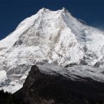
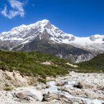
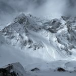
You can start the Manaslu Circuit Trek from Pokhara instead of Kathmandu—the drive simply routes through Dumre and Arughat to reach Machha Khola, the trailhead both cities share.
Almost every Manaslu Circuit guide online assumes you are starting in Kathmandu. That makes sense — it’s Nepal’s main international gateway, and most trekking agencies are based there. But if you are already in Pokhara, flying in through Pokhara International Airport, or simply combining Manaslu with time in the Annapurna region first, there’s no reason to backtrack into Kathmandu just to start walking.
This guide sets out a 12-day Manaslu Circuit Trek itinerary that begins in Pokhara and ends at Besisahar. The final leg drops you back into either Kathmandu or Pokhara — whichever suits your onward plans. It’s built for trekkers with a reasonable fitness base and some prior experience at altitude. But it’s manageable for a well-prepared first-timer with the right acclimatization discipline.
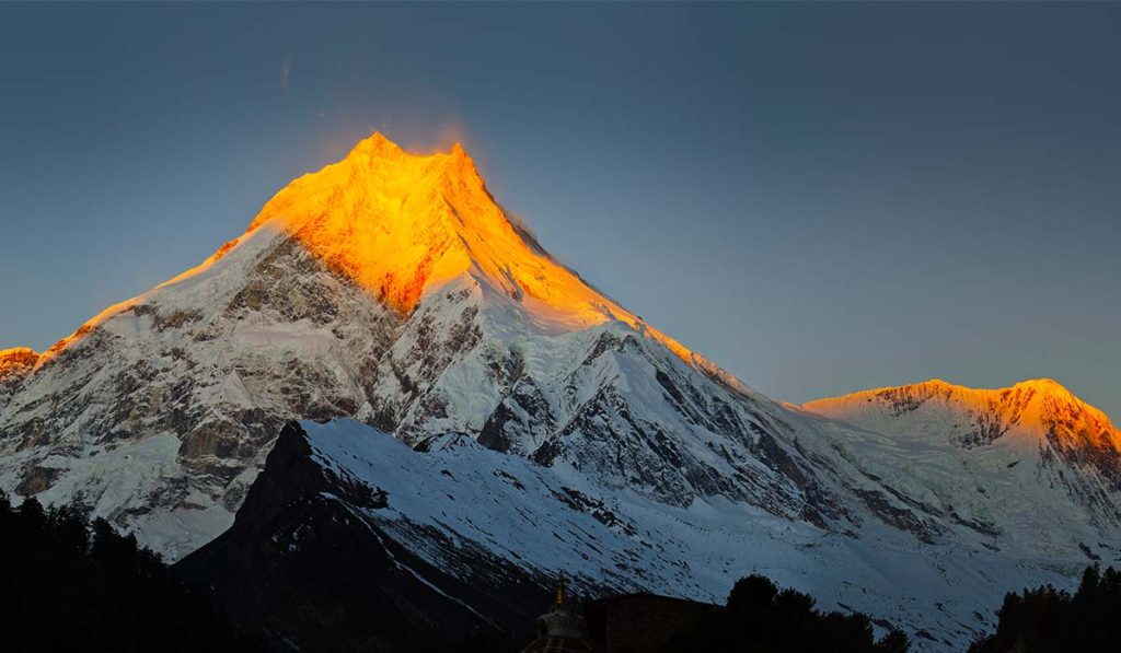
Before the day-by-day route, it’s worth being upfront about one thing: this article covers the Manaslu Circuit Trek, a teahouse trekking route. It is an entirely different undertaking from a Manaslu expedition. The latter is a mountaineering climb to the 8,163-meter summit using ropes, oxygen, and a multi-week base camp rotation.
Ready to trek Manaslu with a team that knows the Pokhara route well? Radiant Treks has been guiding trekkers through the Manaslu region for years, handling every permit, guide booking, and logistics detail. As such, you can focus on the trail. Get in touch with Radiant Treks to plan your Pokhara-start Manaslu Circuit Trek. Or, request a personalized quote for your dates.

Step 1: Decide Why to Start the Manaslu Circuit Trek from Pokhara
The choice to start from Pokhara rather than Kathmandu is based on geography. The Kathmandu route to the trailhead passes through Dhading Besi and Arughat before reaching Machha Khola. The Pokhara route runs through Dumre and joins the same road at Arughat before continuing to Machha Khola. Both routes converge on the same rough, unpaved final section. The stretch between Arughat and Machha Khola is the roughest part of the drive. So, starting from Pokhara doesn’t shorten it. However, it does remove the need to travel into Kathmandu first if you are not already there.
How To Reach Machha Khola: Pokhara Vs Kathmandu
| From Pokhara | From Kathmandu |
| Distance: 155-165 km | Distance: 160 km |
| Driving Time: 7-8 hours | Driving Time: 7-8 hours |
| Route: Pokhara → Dumre → Arughat → Soti Khola → Machha Khola | Route: Kathmandu → Dhading Besi → Arughat → Soti Khola → Machha Khola |
| Best For: Trekkers already in Pokhara or combining the Manaslu trek with the Annapurna region | Best For: Trekkers arriving in Kathmandu and starting their Nepal trip from the capital |
The real advantage of a Pokhara start isn’t a faster drive. It’s convenience and flexibility. It suits anyone who has just finished an Annapurna-area trek or arrived via Pokhara’s airport. It also works well if you want a single loop that starts near the Annapurna region and finishes there as well. That is because this itinerary ends with a drive back to either Kathmandu or Pokhara from Besisahar.
Step 2: Get Your Permits Sorted
The Manaslu Circuit Trek is a restricted area in Nepal. It means you cannot walk in on a standard trekking permit alone. Three permits are required, and all three must be arranged through a government-registered trekking agency. You cannot apply for the restricted-area permit yourself, whether you are departing from Pokhara or Kathmandu.
What Permits Do I Need For The Manaslu Circuit Trek?
- Restricted Area Permit (RAP): Covers the section from Jagat to Dharapani. It costs USD 100 per person for the first seven days in September-November. Or it is USD 75 for the first seven days in December-August, with an additional daily fee (USD 15 or USD 10, respectively) for each day beyond that.
- Manaslu Conservation Area Permit (MCAP): A flat fee of around USD 30 (NPR 3,000) year-round, funding trail maintenance and conservation work in the Manaslu region.
- Annapurna Conservation Area Permit (ACAP): Also around USD 30 (NPR 3,000). It’s required because the trail crosses into the Annapurna Conservation Area after Larkya La Pass, on the way to Dharapani and Besisahar.
A local municipality fee of roughly USD 8 (NPR 1,000) is also collected on the trail, usually around Jagat or Philim. No TIMS card is needed on this route—the RAP replaces it. Budget at least two full working days in Kathmandu or Pokhara before departure for Radiant Treks to process everything, since permits aren’t issued on weekends.
Also, solo travelers can now get their own RAP. As of March 2026, Nepal’s Department of Immigration has removed the long-standing rule that mandated a minimum of two trekkers to share one RAP. But a licensed guide is still mandatory regardless of group size. It means independent trekking without a guide remains prohibited in the Manaslu restricted area.
Step 3: Buy Travel And Rescue Insurance
Insurance isn’t optional here, and it isn’t just a formality for the permit application. Larkya La Pass sits at 5,106 meters, and helicopter evacuation is the only realistic rescue option above Samagaon if altitude sickness or injury forces an early exit. Make sure your policy specifically covers high-altitude trekking and emergency helicopter evacuation up to at least 6,000 m—many general travel policies cap out lower than that and won’t pay out on this route. Buy it before you leave home; it’s far harder to arrange once you are already in Nepal.
Step 4: Choose The Right Season
If you are choosing between seasons, you have two main options as the best time for the Manaslu Circuit Trek: spring (March–May) and autumn (September–November).
- Autumn is when the mountains show off—skies are clear, weather is stable, and Larkya La is at its most crossable. The trade-off is that everyone else knows this too and wants to take the maximum benefit from this good weather. So, trails and teahouses are busier, and RAP permit rates jump up in this window.
- Spring is the quieter, gentler option. Lower elevations stay mild, rhododendrons are in bloom through the forest sections, and permits cost a little less. The catch is that the pass can still be holding snow early in the season, so timing matters more.
Winter (December–February) and the monsoon months (June–August) are possible but riskier — winter brings a real chance of Larkya La being snowed shut, and monsoon rains increase landslide risk on the lower, unpaved sections of road between Arughat and Machha Khola.
Step 5: Book A Guide, Porter, And Registered Agency
Because the Manaslu region is restricted, you are legally required to trek with a licensed guide booked through an agency registered with the Nepal government and TAAN (Trekking Agencies’ Association of Nepal). When comparing agencies, whether you are booking from Pokhara or Kathmandu, look for:
- A track record specifically on the Manaslu Circuit, not just general Nepal trekking experience
- Transparent permit handling—Your agency should list RAP, MCAP, and ACAP separately in your quote, not bundle them vaguely
- A licensed guide (not just a porter acting as guide) with wilderness first-aid training
- Clear policy on porter loads and porter insurance — this matters ethically as well as practically
Licensed guides typically charge USD 25-35 per day; porters are usually separate and cost less (around USD 20 per day). Confirm whether your quoted price includes food and accommodation for guides and porters, since that’s standard practice but not universal.
Step 6: Train And Prepare Physically
The Manaslu Circuit Trek is achievable for a fit beginner with no prior high-altitude experience, but “fit” needs to mean something concrete: comfortably walking 5-7 hours a day, several days in a row, carrying a daypack. In the two to three months before departure, build toward:
- Hiking with a loaded daypack on consecutive days, not just single long day-hikes
- Stair or hill training to build the specific leg strength climbing days demand
- At least one multi-day hike at elevation beforehand, if you can manage it, so your body has some reference point for how it responds above 3,000 m
No amount of gym training substitutes for proper acclimatization on the trail itself, which is why the itinerary below builds in dedicated rest days rather than compressing the schedule further.
Step 7: Follow The 12-Day Route From Pokhara To Besisahar
Follow this route day by day, from the trailhead to Besisahar, with altitude, approximate distance, and walking time for each stage. Altitudes are overnight elevations unless otherwise noted.
This itinerary is the day-by-day route, grouped by phase of the trek. Altitudes are overnight elevations unless otherwise noted.
Getting To The Trailhead
Day 1: Pokhara to Machha Khola (869m). A long drive of about 160 km via Dumre, Arughat, and Soti Khola. Expect 7 to 8 hours on the road, including the roughest, unpaved stretch of the whole trip.
Lower Manaslu: river valley and forest
Day 2: Machha Khola to Jagat (1,340m). This section is about 20 km long and takes roughly 6 to 7 hours to walk.
Day 3: Jagat to Deng (1,860m). The longest walking day on the lower trail. The distance is about 20 to 22 km, and the time is 6 to 8 hours.
Day 4: Deng to Namrung (2,630m). Around 19 km, 6 to 7 hours. This stage is often where trekkers first start noticing the altitude.
Upper Manaslu: Alpine Terrain And Acclimatization
Day 5: Namrung to Syala (3,520m). The trek covers about 18 km and takes 6 to 7 hours, with a rapid elevation gain.
Day 6: Syala to Samagaon, via Pungyen Gompa (3,530m). A shorter day, around 8 km and 4 to 5 hours, built in ahead of acclimatization.
Day 7: Acclimatization day in Samagaon. A side hike to Manaslu Base Camp (roughly 4,800m) or Birendra Lake, covering 6 to 10 km over 4 to 6 hours. You sleep at the same altitude you woke up at.
Day 8: Samagaon to Samdo (3,860m). The trek is about 9 km and takes 4 to 5 hours.
Day 9: Samdo to Dharamsala, or Larke Phedi (4,460m). Around 12 km, 4 to 5 hours. This is the last stop before the pass.
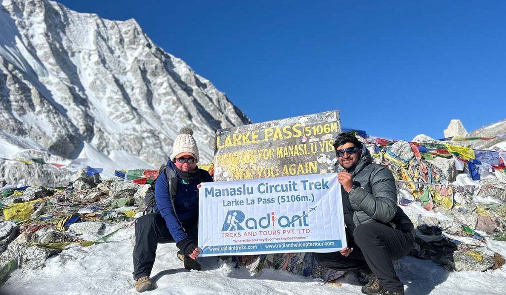
Day 10: Dharamsala to Bhimtang, via Larkya La Pass (5,106m, descending to 3,720m). This is the longest and hardest day of the trek, covering about 24 km and taking 7 to 9 hours. Most groups leave before sunrise to clear the pass before the afternoon wind picks up.
Day 11: Bhimtang to Besisahar (about 760m). Trek to Dharapani or Tilje, then drive the rest of the way. The total distance is around 25 km, taking 6 to 8 hours.
The Exit
Day 12: Besisahar to Kathmandu or Pokhara. Kathmandu is about 180 to 200 km, 5 to 6 hours. Pokhara is closer, about 100 km, 3 to 4 hours.
Days 7 and 9 are the two acclimatization anchors of the trek. Samagan covers the hike to the base camp, and Samdo serves as the final buffer before the hardest day on the route.
Step 8: Know The Difficulty Before You Go
Is the Manaslu Circuit Trek hard? For a fit beginner with no prior high-altitude experience, yes — noticeably harder than the Annapurna Base Camp trek or the Everest Base Camp trek’s early stages, mainly because of Larkya La Pass.
Crossing at 5,106 meters in a single long day, often in low temperatures and wind, is the trek’s real test. The daily distances themselves — mostly 15-24 km on well-established trails — aren’t technically difficult; there’s no climbing gear, ropes, or technical terrain involved anywhere on the circuit.
The point is worth repeating clearly: this difficulty rating applies to the trek, not a Manaslu expedition. Summiting Manaslu itself (8,163 m) is a technical high-altitude mountaineering objective, involving fixed ropes, crampons, supplemental oxygen for most climbers, and a multi-week rotation through higher camps above base camp.
While it sits in a different category of risk and preparation from the trekking route described in this guide, it is not off-limits to beginners. With the right training, gradual acclimatization, and a licensed guide, trekkers with no prior high-altitude experience have completed it successfully.
Who should think twice about the 12-day pace specifically: anyone with no multi-day hiking experience at all, anyone with a known heart or lung condition without medical clearance, and anyone unable to add extra acclimatization days if they start showing symptoms of altitude sickness.
If you are uncertain about your acclimatization, discuss a longer itinerary with Radiant Treks before booking. We can customize the itinerary as per your requirements.
Step 9: Budget For The Trek
How much does the Manaslu Circuit Trek cost? A standard 12-day trek booked through Radiant Treks typically costs about USD 550 per person (for a budget package). Meanwhile, luxury private options are pricier.
A package at this price generally covers your permits (RAP, MCAP, and ACAP), a licensed guide, a porter, teahouse accommodation, and meals for the full trek.
Here’s what’s usually not included and roughly what to carry in cash for each:
- Tips for your guide and porter: Budget USD 100-150 total for a 12-day trek, carried in cash and given at the end.
- Wifi and charging at teahouses: USD 2-5 per use, rising with altitude. Plan on USD 30-50 for the full trek if you want daily access.
- Hot showers: USD 2-6 per shower, also pricier in higher villages. Another USD 20-30 buffer should comfortably cover the trek.
- Snacks, bottled water, and extra drinks: USD 30-50 for the trip, though a water purification method can cut this down significantly.
- Souvenirs and personal purchases: Entirely up to you, but even a modest budget is worth planning for at Samagaon or Bhimtang, where the more interesting local crafts show up.
- Extra nights or delays: If weather or acclimatization needs push the trek a day or two longer, budget an extra USD 40–60 per additional day for accommodation and meals.
All told, carrying an extra USD 250-350 in cash beyond your package price provides a comfortable buffer for a 12-day trek. Remember, there are no ATMs beyond Arughat, so you need to have cash on hand before leaving the roadhead.
Step 10: Pack The Right Gear
Packing for the Manaslu Circuit Trek means preparing for two very different climates in the same trip—humid, forested lower valleys near Machha Khola and Jagat, and freezing, wind-exposed conditions at Larkya La. Core items:
- Layered clothing: moisture-wicking base layers, a fleece or down mid-layer, and a windproof/waterproof outer shell
- A 4-season sleeping bag rated to at least -15°C for the high camps around Samdo and Dharamsala
- Sturdy, broken-in trekking boots plus lightweight camp shoes
- Trekking poles — genuinely useful on the steep Larkya La descent
- Sun protection: high-SPF sunscreen, sunglasses rated for glacier glare, a sun hat
- A basic personal first-aid kit including Diamox (consult a doctor before your trip) and blister care
- A headlamp for the pre-dawn start on pass-crossing day
If your plan is a summit attempt rather than the trek, note that Manaslu expedition gear (technical mountaineering boots, crampons, ropes, and oxygen systems) is entirely outside the scope of this packing list—that’s specialized climbing equipment arranged separately with an expedition operator, not something a trekking agency provides.
Step 11: Handle Altitude Sickness And Trail Safety
Most trekkers start feeling early effects of altitude somewhere around Namrung (2,630m), and risk increases steadily from there. The standard precautions apply: ascend gradually, drink more water than feels necessary, and avoid alcohol above 3,000 meters. Also, take the built-in acclimatization days at Samagaon and Samdo seriously rather than treating them as optional rest days to skip.
Know the warning signs of acute mountain sickness—persistent headache, nausea, dizziness, and loss of appetite—and tell your guide immediately if you experience them. The only real treatment for worsening symptoms is descent; a licensed guide will know when that decision needs to be made, which is another reason trekking without one isn’t just illegal here; it’s genuinely riskier.
Step 12: Stay Connected—Money, SIM Cards, And Wi-Fi On The Trail
There are no ATMs beyond Arughat, so carry all the Nepali rupees you will need in cash before starting the trek — card payments are essentially nonexistent once you’re past the roadhead. Budget extra cash for WiFi access, hot showers, and battery charging at teahouses, all of which are typically paid for separately and get pricier with altitude.
A local SIM card (NTC or NCELL) will give patchy data access in the lower villages, largely disappearing above Namrung. Most teahouses from Machha Khola up through Samagaon offer paid wifi, though speed and reliability drop the higher you go, and connectivity above Samdo is unreliable at best.
Final Words
Starting the Manaslu Circuit Trek from Pokhara doesn’t shorten the journey or simplify the permits — it simply removes the need to route through Kathmandu first if you are already on the Pokhara side of Nepal. The core trek itself is unchanged: 12 days, three permits, a mandatory guide, and one demanding crossing at Larkya La Pass before the trail delivers you to Besisahar and onward to whichever city suits your next move.
Get the permits and season right, train properly, and the rest of the trek is a matter of pacing yourself through some of the most remote, least-crowded high-Himalayan scenery in Nepal.
Frequently Asked Questions
Can I Start The Manaslu Circuit Trek From Pokhara Instead Of Kathmandu?
Yes. Both routes converge on the same road at Arughat before continuing to Machha Khola, the trailhead. A Pokhara start covers roughly 155-165 km and takes about 7-8 hours by private jeep, a similar drive time to starting from Kathmandu. The difference isn’t speed; it’s convenience if you’re already on the Pokhara side of Nepal.
How Many Days Does The Manaslu Circuit Trek Take?
Most itineraries run 12 to 15 days. This guide follows a 12-day version from Pokhara to Besisahar, though many agencies offer 13- to 14-day itineraries with an extra acclimatization or buffer day built in. If it’s your first time trekking at altitude, a longer itinerary gives you more room to adjust if the pace feels too fast.
Do I Need A Guide For The Manaslu Circuit Trek?
Yes. The Manaslu region is a restricted area. And as per the rules applied to such regions, one must trek with a licensed guide booked through a registered agency. This is legally mandatory for every foreign trekker, regardless of group size or experience level. This isn’t a formality either—the guide carries your permits and presents them at checkpoints, and they’re the one who makes the call to descend if altitude sickness becomes a concern.
Can I Trek The Manaslu Circuit Solo?
As of March 2026, yes, in the sense that Nepal removed the old rule requiring two trekkers to share a single Restricted Area Permit. A solo traveler can now get their own RAP. What hasn’t changed is the guide requirement. You still can’t walk the Manaslu Circuit independently without a licensed guide, so “solo” here means solo group size, not solo without support.
What Is The Highest Point Of The Manaslu Circuit Trek?
Larkya La Pass, at 5,106 meters, is the highest point on the Manaslu Circuit Trek. It’s crossed on a single long day between Dharamsala and Bhimtang, and it’s the day most of the trek’s difficulty is concentrated into.
Where Does The Manaslu Circuit Trek End?
The trek ends at Besisahar, after descending from Bhimtang via Dharapani and Tilche. From Besisahar, trekkers continue by road to either Kathmandu or Pokhara, depending on where they need to be next.
Is The Manaslu Circuit Trek Harder Than The Annapurna Circuit?
It’s generally considered slightly more demanding overall. That is mainly due to its remoteness, thinner infrastructure, and mandatory guide requirement. It is not because Larkya La (5,106m) is technically harder than Thorong La (5,416m). The latter is actually the higher of the two passes.
Is The Manaslu Circuit Trek The Same As A Manaslu Expedition?
No. The Manaslu Circuit Trek is a teahouse trekking route that circles the mountain without any technical climbing. A Manaslu expedition is a separate, technical mountaineering climb to the 8,163 m summit, requiring ropes, oxygen, and a multi-week high-altitude climbing rotation.
How Difficult Is The Manaslu Circuit Trek For A Beginner?
It’s manageable for a fit beginner with no prior high-altitude experience, but “fit” needs to mean comfortably walking 5-7 hours a day for several days in a row. The daily distances themselves aren’t technical; there’s no climbing gear involved anywhere on the route, but Larkya La Pass is a real physical test regardless of experience level, simply because of the altitude and the length of that single day.
Do I Need Travel Insurance For The Manaslu Circuit Trek?
Yes, and it needs to specifically cover high-altitude trekking and emergency helicopter evacuation up to at least 6,000 meters. Above Samagaon, helicopter evacuation is the only realistic rescue option if altitude sickness or injury forces an early exit, and many standard travel policies don’t cover that. It’s worth arranging before you leave home rather than trying to sort it out in Nepal.
What Permits Are Required For The Manaslu Circuit Trek?
Three permits: the Restricted Area Permit (RAP), the Manaslu Conservation Area Permit (MCAP), and the Annapurna Conservation Area Permit (ACAP). All three are arranged through your trekking agency, and none of them can be applied for independently. A small local municipality fee is also collected on the trail, usually around Jagat or Philim.
Can I Add The Tsum Valley To A Manaslu Circuit Trek Itinerary?
Yes, Tsum Valley is a common extension for those trekkers who have more time and want to experience something unique. It branches off the main Manaslu route and requires an additional Tsum Valley Restricted Area Permit on top of the standard three. If this option interests you, it’s worth raising with your agency at the booking stage, since it changes both your permit costs and your total trip length.
What’s The Best Time Of Year To Trek The Manaslu Circuit?
Spring (March-May) and autumn (September-November) are the two established windows. Autumn gives the clearest mountain views and the most stable conditions for crossing Larkya La, while spring is quieter and slightly cheaper, with rhododendrons in bloom through the lower forest sections.
Is There Mobile Signal Or WiFi On The Manaslu Circuit Trek?
Mobile signals and WiFi are patchy at best, and they get worse the higher you go. A local SIM card gives some data access in the lower villages, largely disappearing above Namrung. Most teahouses from Machha Khola through Samagaon offer paid wifi, but connectivity above Samdo is unreliable, so it’s worth telling people back home not to expect regular updates once you’re past the halfway point.
What Should I Budget For Extra Costs Beyond The Package Price?
A standard package usually doesn’t include tips, wifi, hot showers, snacks, or souvenirs. Carrying an extra USD 250-350 in cash beyond your package price provides a comfortable buffer for a 12-day trek. There are no ATMs beyond Arughat, so this cash needs to be in hand before you leave the roadhead.